Big Earth Hacks water

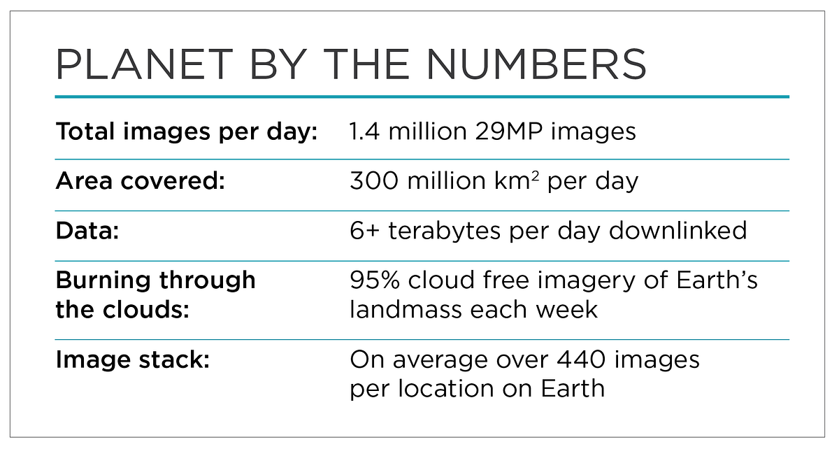
As Planet achieved mission one last year it started to map the entire planet every single day. With this came the need to store tremendous amount of data, being able to serve it using our faboulous Planet Explorer and for you be able to dowload it after you created an account. While getting imagery became critically important , the delivery method lead to questions about platforms for analysis. Mission one further meant that you would be able to analyze time series datasets over weekly and bi weekly periods and understand questions that require dynamic analysis such as vegetation patters, climate variability and changes in hydrological cycles. It generated the single largest trove of high frequency dataset in existence with an unprecedented cadence or repeat over areas.
With the need to handle such global-scale and often massive data sets, Google was already building and hosting a platform called Google Earth Engine(GEE) designed to analyze geo-spatial data. Google Earth Engine is a cloud based analysis platform that allows for an indexable and queriable raster and vector environment while including and expanding on raster capabilities. It allows for users to perform large scale analysis on large scale datasets such as Planet's very own. You can read more about the Google Earth Engine platform here
These set of tutorials will introduce you to methods in getting imagery onto the Google Earth Engine platform, and how do you quickly visualize and analyze the datasets with the GEE platform. With the multitude of tools and possibilities of building your own analysis tools. The first of it's kind tools will include basic methods such as 4 band operations and can include complex operations in machine learning as the platform evolves.
For more information and developer guide on Google Earth Engine you can visit their developer console.